

GIS
Szolgáltatásunkról
Egyedi megoldásokat kínálunk ügyfeleink számára térinformatikai adatbázisok fejlesztésében, karbantartásában, illetve vállaljuk meglévő adatbázisok fejlesztését, térképek készítését, online platformok létrehozását. Együttműködő partnereink révén segítséget tudunk nyújtani közműkutatásban, talajradaros és LiDAR felmérésben egyaránt, egy biztos alapot szolgáltatva ezzel a későbbi munkafolyamatokhoz.
A földrajzi információs rendszer (geographic information system - GIS) az adatok gyűjtéséhez, kezeléséhez és elemzéséhez nyújt keretrendszert. A földrajz tudományában gyökerező GIS sokféle adatot integrál. Elemzi az objektumokat, azok elhelyezkedését, lehetőséget nyújt az adatok grafikus, térbeli megjelenítéséhez, emellett a földrajzi jelenségek megfigyelésére, modellezésére is szolgál. Az ilyen jellegű szolgáltatások napjainkban egyre nagyobb népszerűségnek örvendenek, hiszen jól támogatja a felhasználót a minél alaposabb döntéshozatalban.

GIS
szolgáltatások

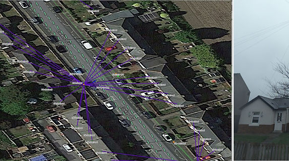
Digitális térképek előállítása
Digitális térképeket készítünk, ellenőrzünk és egészítünk ki, szükség esetén javítjuk a topológiai hibákat.
Ezeket a feladatokat a már rendelkezésre álló raszteres és vektoros alapadatok felhasználásával hajtjuk végre. Megrendelőink igénye szerint az alapadatok beszerzésében, illetve partnereink révén a felmérésekben is tudunk segítséget nyújtani.

Adatintegráció
Vállaljuk leíró és térképi adatok integrációját. Különböző térképeken és adatbázisokon elvégezzük a szükséges integrációs átalakításokat, úgy mint: szkennelés, digitalizálás, transzformálás, geokódolás, formátumváltás, adatmegfeleltetés.
GIS rendszerek tervezése, megvalósítása
Segítséget tudunk nyújtani ügyfeleinknek az igényeiknek megfelelő térinformatikai rendszer kidolgozásában, bevezetésében, illetve az így felépített rendszerek használatának betanításában is szerepet tudunk vállalni. A gazdaságosság érdekében nyílt forráskódú megoldásokat használunk.

